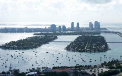
As a coastal city with an average elevation just a few feet above sea level, Miami is already being affected by climate change and its attendant rise in sea levels. Confronting Climate Change, a new StoryMap created by Bri Rodgers (C’22) for Professor Yuki Kato’s Environmental/Food Justice Movements course and entered in the Fall 2020 Library Showcase, examines how these changes are driving gentrification in Miami. StoryMaps, a tool for creating text narratives with embedded media and maps, was a perfect fit for the project.
“I knew I wanted to explain the current context, but also how the city got here,” Rodgers, a Miami native, said. City development policies traditionally gave preference to desirable waterfront property to white residents, while Black and Latino were relegated to inland areas. But those areas are now becoming more desirable, because their higher elevations leave them less immediately susceptible to the effects of climate change.
So far, the city has taken a largely neoliberal, market-driven approach to addressing gentrification of these areas due to the effects of climate change, Rodgers said. “I found the response from the local government interesting, but also that they haven’t incorporated a lot of dialogue with the people who live in these areas,” she noted. When she returns to Miami for the summer, she plans to work with activists trying to reduce the rate of displacement and improve the stock of public housing in the city.
Professor Kato consulted with the Library while developing the assignment and Digital Scholarship Librarian Megan Martinsen visited the class virtually to teach students how to use StoryMaps. “I found it really helpful to be able to create a StoryMap and focus on a specific area I’m interested in,” Rodgers said. “It’s an opportunity for students to engage in something they’re passionate about and can use for the future.”